It seems like each coordinate will provide us with a letter for the flag. However, there is an issue. We do not know which letter we should take. It could be in the city name, or the country name.
Approach
We continue by using some geolocation tool to find the different locations, such as Google Maps. After some trial and error, I realised that we are supposed to take the first character of the city name at each location.
Getting the Flag
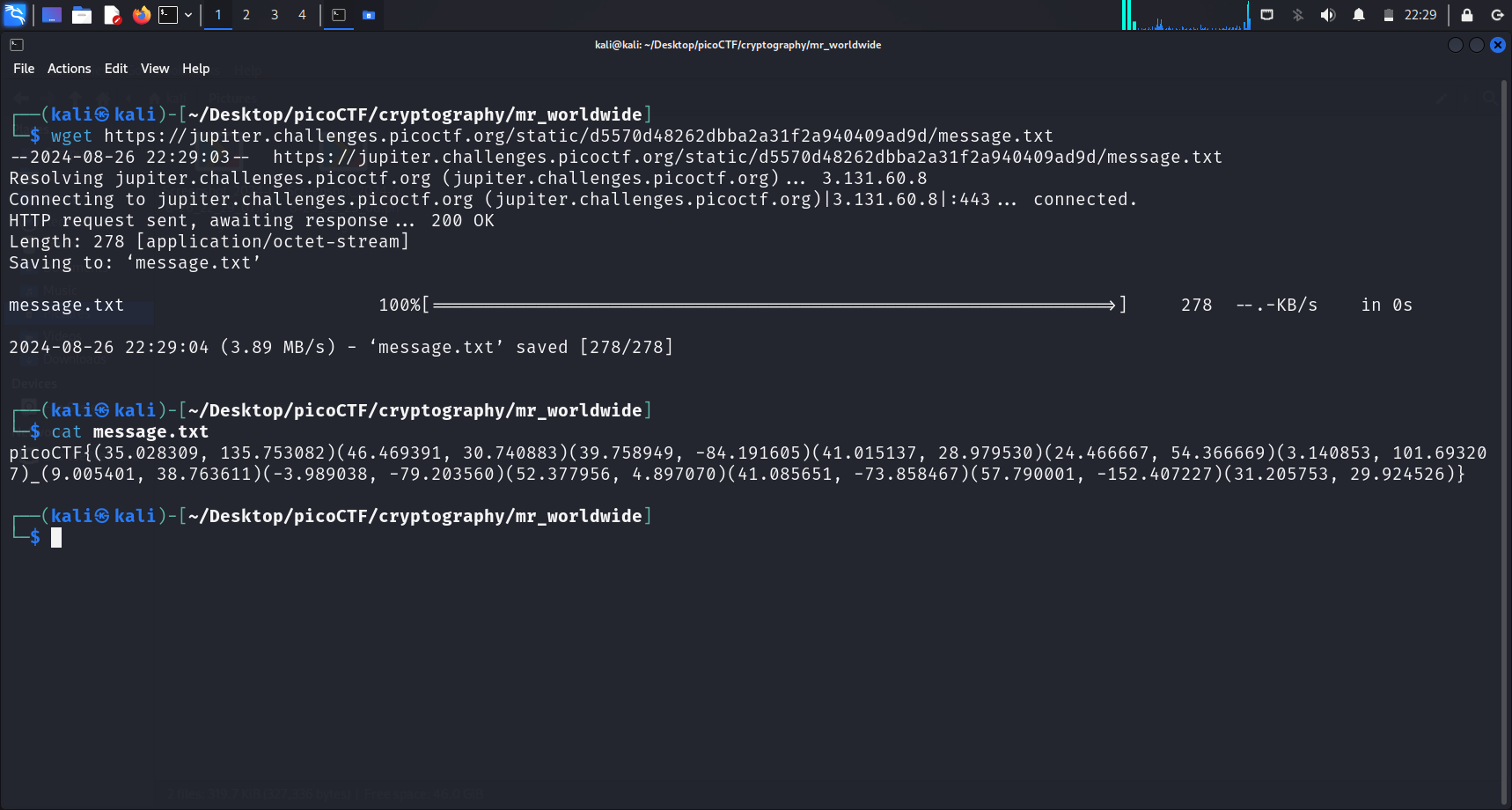
[K]yoto, Japan (35.028309, 135.753082)[O]dessa, Ukraine (46.469391, 30.740883)[D]ayton, Ohio, USA (39.758949, -84.191605)[I]stanbul, Turkey (41.015137, 28.979530)[A]bu Dhabi, UAE (24.466667, 54.366669)[K]uala Lumpur, Malaysia (3.140853, 101.693207)_[A]ddis Ababa, Ethiopia (9.005401, 38.763611)[L]oja, Ecuador (-3.989038, -79.203560)[A]msterdam, Netherlands (52.377956, 4.897070)[S]leepy Hollow, New York, USA (41.085651, -73.858467)[K]odiak, Alaska, USA (57.790001, -152.407227)[A]lexandria, Egypt (31.205753, 29.924526)